

The Connections Between Monterey, California; the Indian Ocean Southeast of Madagascar; and Birjand, Iran
Growing up, it was commonly thought that if we were able to tunnel straight down through the earth, we would eventually pop our heads out, gopher like, somewhere in China (I grew up in northern California, by the way).
Another way of thinking about that location (an easier way to get there, for sure) is to hitch a ride on your local meridian of longitude (the imaginary line going north/south) and travel halfway around the earth. This is probably a cleaner and safer way of getting there, too (as opposed to turning yourself into a human drillbit).
So how can you figure out what that location is, and plot it on a Bing Map using Map-O-Matic?
In a sense, it is a math problem. First, you determine your local coordinates (more on that soon), then you add 180 to the latitude (north/south) value.
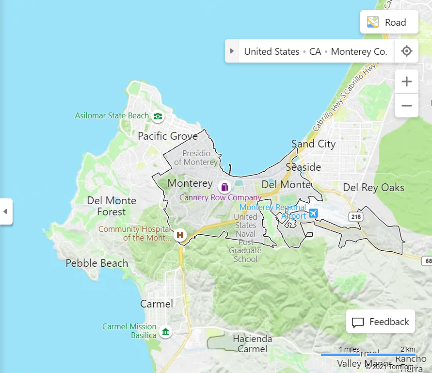
So, for example, if you live in Monterey, California, you can search for your location at the Bing Maps site.
You can then right-click on the map at your location and select "Copy" to copy the coordinates to your computer's clipboard. Then paste them into a text file.
This is what I see after entering "Monterey California" in the search box at the Bing Maps site:
Right-clicking near where I live, I see this (the Coordinates and the "Copy" text is highlighted):

Now paste those coordinates into a text file. You will have something like this:
36.590208, -121.889534Because I don't care about being THAT precise as to location and to make the mathematical calculation easier, I round and truncate the values to this:
36.6, -121.89...and then replace the ", " with ";" (the semicolon that Map-O-Matic expects), like so:
36.6;-121.89Then I prepend a color value for the pushpin (the name of one of the 15 colors Map-O-Matic makes available, followed by a tilde symbol) and a description that will show when hovering over that point, followed by a semicolon:
Purple~Monterey, California;36.6;-121.89So now how to get the antipode (the opposite side of the globe)?
Add 90 to the latitude value. If you move 180 points or degrees north you will hit 90 (the North Pole) after 53.4 (36.6 + 53.4 = 90). But then you still have 126.6 to go. At this point (90, the top of the world), the numbers representing the latitude become negative, from -90 to 0 (Equator). So at the Equator you have gone 143.4 points (53.4 + 90). You still have 36.6 to go (180 – 143.4 = 36.6). So you end up at -36.6 after moving those remaining 36.6 points “up” from the equator on the other side of the globe.
Note: If all this seems confusing, it was to me, too. I wrote a question about it to those who should know at the Earth Science site on StackOverflow. If interested, check out that thread here.
So your text file now can look like this:
Purple~Monterey, California;36.6;-121.89Teal~Indian Ocean, southeast of Madagascar (nearest city is Tôlanaro, Madagascar);-36.6;58.11As you can see, the latitude values are simply reversed (36.6 and -36.6).
Also, you can see -- perhaps in surprise -- that halfway around the earth from Monterey is in the Indian ocean. So if you go ahead and (in the interests of science/experimentation) do drill through the earth from Monterey, be sure to wear not only an asbestos suit (to withstand the heat at the earth’s core) and sunglasses (because of the bright magma), but also have a floaty with you so you can “cool your jets” while waiting for a passing trawler to pick you up after you pop your head out at the Indian Ocean.
But what about halfway around the world in the other direction? In other words, going east or west, along the same parallel of latitude, changing longitude instead of latitude. The difference this way is also 180 points or degrees. So from Monterey, you retain the same latitude of 36.6, but add 180 to the longitude, ending at 58.11 (from Monterey’s -121.89 to Greenwich at longitude 0, then another 58.11 to go full the 180). So your text file is now:
Purple~Monterey, California;36.6;-121.89Teal~Indian Ocean, southeast of Madagascar (nearest city is Tôlanaro, Madagascar);-36.6;58.11Chocolate~Birjand, Iran;36.6;58.11Note: Because parallels of latitude are longest at the equator (picture the equator as earth’s fat belly), and get shorter as you move further and further away from the equator in either direction, north or south (picture the areas near the poles as the earth’s pencil-neck or ankles), the distance in miles to go halfway around the earth differ depending on which latitude you are on; the degree difference will always be 180, though.
So again, we arrived at a longitude of 58.11 for the longitudinal midway point from Monterey by traveling 121.89 points east to get to Longitude 0/Zero (which runs through Greenwich, England) and then adding the difference between that and 180, which is the arrived-at 58.11. The location that is halfway around the world for Monterey is Birjand, Iran.
When I run this file in Map-O-Matic, I see this:

Here it is with captions:

You can do the same with any starting point - determine what is halfway around the world from where you live, or from some other place you're interested in. Of course, you can go either north or south when changing latitude, as halfway around the world is the same distance going either direction. The same goes for changing longitude - go either east or west. That’s the definition of halfway around the world - it’s “six of one and half-a-dozen of the other” whether you go north or south to get there (along a meridian of longitude) or whether you travel east or west (along a parallel of latitude).
A way to picture this is to imagine sending out four drones or Pterodactyls, each one heading in one of the cardinal directions (North, East, South, West) at the same speed. Those sent north and south from Monterey would meet at that spot in the Indian Ocean, while those sent east and west would experience a midair collision over Birjand, Iran.
This is just one example of the interesting, useful, and even fun things you can do with Map-O-Matic, which is available in the Microsoft Store.