


HOW TO USE MAP-O-MATIC (#2 in a Series)
Specify Pushpin Colors for Your Map’s Locations

In the previous (first) article in this series here, I showed how to add pushpins to a map. In this article, as promised, I will show you how to designate one of 15 colors for each location. In this way you can either categorize the type of pushpins you are displaying, or use different colors simply to add visual interest to your map.
An example of a map where you might want to categorize pushpins based on a certain criteria, I created some maps of the U.S. Civil War, showing where battles took place in a given year of that conflict, and made Union victories blue, Confederate victories gray, and "undetermined" outcomes ("draws" or Pyrrhic victories) black, as you can see here (with captions added to the screenshot):

As to the example, though, it will be an easier and shorter one. If you are creating your map from a text file, all you need to do is add the name of the color you want the pushpin to be followed by a tilde (~ symbol) on each line, e.g.:
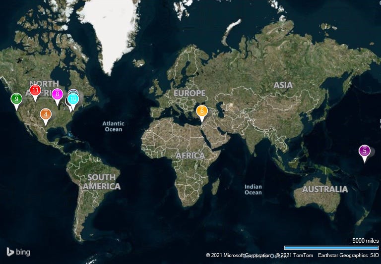
Blue~Baseball Hall of Fame, Cooperstown, NY;25 Main St;Cooperstown;New York;13326Grey~Silver Spring, Maryland;11701 Berwick Road;Silver Spring;Maryland;20904Black~Washington, D.C.;1600 Pennsylvania Avenue NW;Washington;D.C.;20500Chocolate~Alamo, Texas;300 Alamo Plz;San Antonio;Texas;78205Purple~Gilbert Islands/Kiribati;;Abemama Kariatebike;Gilbert Islands Kiribati;KI0112Orange~Dome of the Rock, Jerusalem, Israel;Dome of the Rock;Jerusalem;Israel;9103401Teal~Yasger's Farm, Woodstock, New York;34 Yasgur Rd;Bethel;New York;12720Red~Oconomowoc, Wisconsin;811 W Wisconsin Ave;Oconomowoc;Wisconsin;53066Green~Zenia, California;140 Zenia Bluff Road;Zenia;California;95595Cyan~Philadelphia, Pennsylvania;;Philadelphia;Pennsylvania;19019DarkRed~Little Bighorn Battlefield National Monument ("Custer's Last Stand");I-90 Frontage Rd;Crow Agency;Montana;59022You must use one of the 15 colors Map-O-Matics available (and, if using a text file to create your map, be sure to spell it right). The colors you can use are:
RedOrangeYellowGreenBlueIndigoVioletCyanMagentaBlackGrayTealPurpleChocolateDarkRedNote: If you don't specify a color, the location's color will be Gold by default.
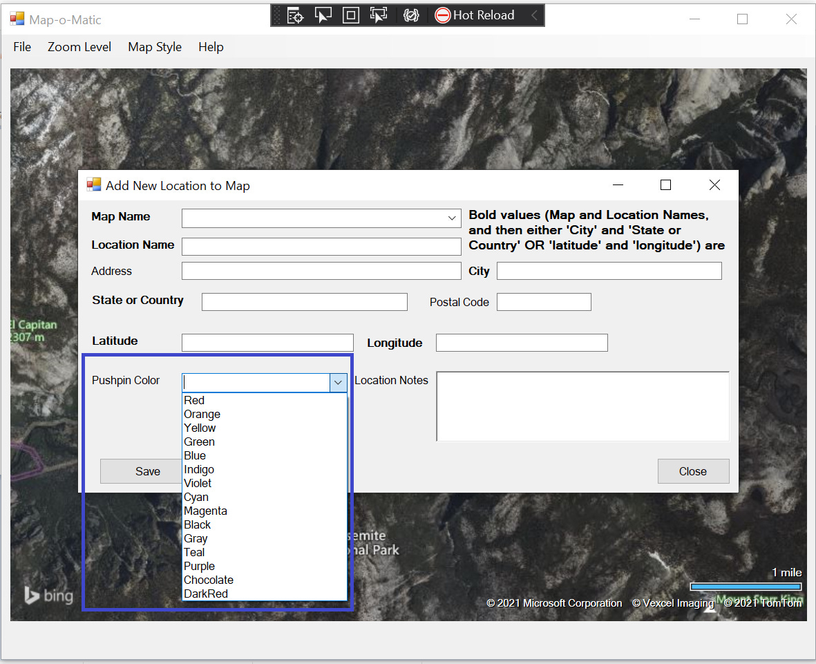
Besides specifying them in a text file, you can also add the colors when you create the locations manually in the app via File > Create New Map Manually ... and then File > Add Location to an Existing Map, or when updating existing locations via File > Update Location on an Existing Map ...
On the forms that display, a dropdown is available from which you can select which of the 15 colors you want to make the location. Representative of both forms, here is the one you see when you select the first one mentioned:
For specifics on using those menu options, see the article introducing Map-O-Matic here and the videos to which that article has links.
As an example of what we can do by specifying colors for locations on our maps, here is what displays when loading the text file shown above, with the prepended color designations:
To see the U.S. locations better, we can zoom in (I also changed the map style to “Road”):

There’s stil a bit of a “traffic jam” involving Silver Spring, Maryland and Washington, D.C. We can zoom in on that, too:

In the next article in this series, I will demonstrate another Map-O-Matic feature.